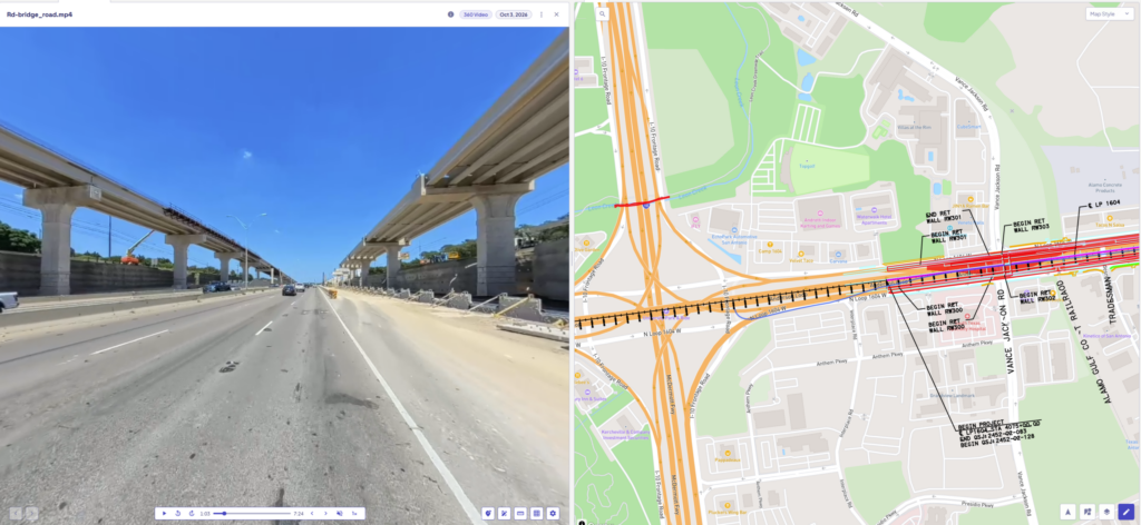
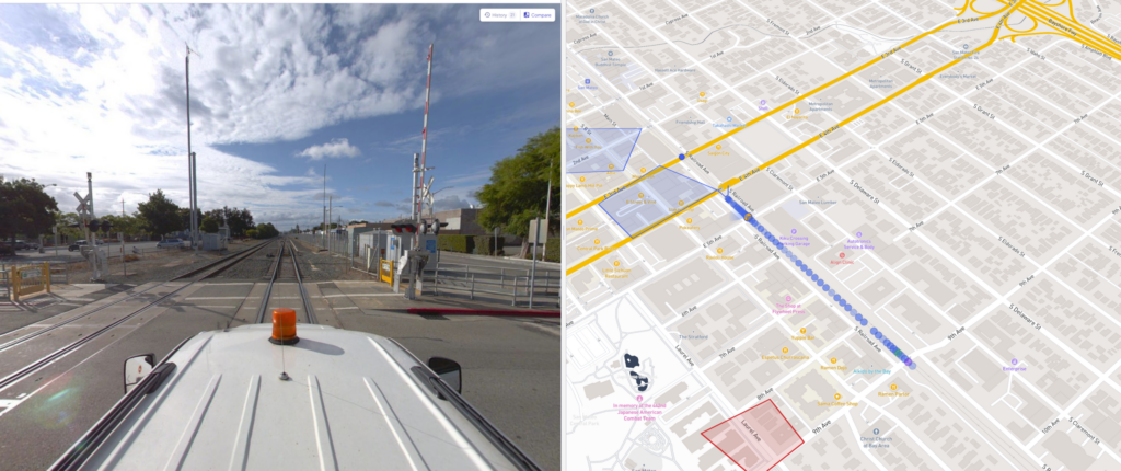
Railway Mapping

[vc_row full_width=”stretch_row” disable_element=”yes” el_id=”section-1″][vc_column][ocumap_hero_section section_style=”v2″ breadcrumps=”true” sentences_color=”#ffffff” section_img=”2630″ css=”.vc_custom_1687435361752{background-image: url(https://ocumap.sytes.net/wp-content/uploads/2023/01/Group-105.jpg?id=2159) !important;background-position: center !important;background-repeat: no-repeat !important;background-size: cover !important;}”][/vc_column][/vc_row][vc_row][vc_column][vc_empty_space height=”2.083vw” max_height=”40px” mobile_height=”25px”][/vc_column][/vc_row][vc_row el_id=”section-2″][vc_column][vc_empty_space height=”4.375vw” max_height=”84px”][vc_custom_heading text=”Right of Way Video Mapping” font_container=”tag:h2|font_size:2rem|text_align:center” use_theme_fonts=”yes” font_weight=”regular” css=”.vc_custom_1694201693870{margin-top: 0px !important;margin-bottom: 0px !important;}” el_class=”w-color”][vc_custom_heading text=”Streamline visual documentation of your mainlines and branches” font_container=”tag:p|font_size:1.4rem|text_align:center” use_theme_fonts=”yes” font_weight=”light” el_class=”w-color”][vc_single_image image=”2950″ img_size=”full” el_class=”section-img”][vc_row_inner][vc_column_inner offset=”vc_col-lg-6 vc_col-md-6″][vc_custom_heading text=”Virtual Track Inspection” font_container=”tag:h3|font_size:1.667rem|text_align:left|color:%23ffffff” use_theme_fonts=”yes” font_weight=”bold” mobile_fontsize=”1.4rem”][vc_custom_heading text=”Bring the entire track onto your desktop and revisit it as many times as needed” font_container=”tag:p|font_size:1.467rem|text_align:left|color:%23ffffff” use_theme_fonts=”yes” font_weight=”light” mobile_fontsize=”1.3rem”][/vc_column_inner][vc_column_inner offset=”vc_col-lg-6 vc_col-md-6″][vc_custom_heading text=”Locate Above Ground Assets” font_container=”tag:h3|font_size:1.667rem|text_align:left|color:%23ffffff” use_theme_fonts=”yes” font_weight=”bold” mobile_fontsize=”1.4rem”][vc_custom_heading text=”Generate an asset inventory of all above ground utilities with a single run” font_container=”tag:p|font_size:1.467rem|text_align:left|color:%23ffffff” use_theme_fonts=”yes” font_weight=”light” mobile_fontsize=”1.3rem”][/vc_column_inner][vc_column_inner offset=”vc_col-lg-6 vc_col-md-6″][vc_custom_heading text=”Off the Shelf Camera” font_container=”tag:h3|font_size:1.667rem|text_align:left|color:%23ffffff” use_theme_fonts=”yes” font_weight=”bold” mobile_fontsize=”1.4rem”][vc_custom_heading text=”Use any GPS-enabled camera to record GPS videos or GPS imagery” font_container=”tag:p|font_size:1.467rem|text_align:left|color:%23ffffff” use_theme_fonts=”yes” font_weight=”light” mobile_fontsize=”1.3rem”][/vc_column_inner][vc_column_inner offset=”vc_col-lg-6 vc_col-md-6″][vc_custom_heading text=”Organize your Track data” font_container=”tag:h3|font_size:1.667rem|text_align:left|color:%23ffffff” use_theme_fonts=”yes” font_weight=”bold” mobile_fontsize=”1.4rem”][vc_custom_heading text=”See alignment, stations, MPs and Xings on videos and on map data.” font_container=”tag:p|font_size:1.467rem|text_align:left|color:%23ffffff” use_theme_fonts=”yes” font_weight=”light” mobile_fontsize=”1.3rem”][/vc_column_inner][vc_column_inner][vc_empty_space height=”2.917vw” max_height=”56px”][/vc_column_inner][/vc_row_inner][/vc_column][/vc_row][vc_row][vc_column][vc_empty_space height=”2.344vw” max_height=”45px” mobile_height=”25px”][/vc_column][/vc_row][vc_row equal_height=”yes” content_placement=”middle” css_animation=”fadeInUp” title=”Request A Demo” style=”flat” gradient_color_1=”turquoise” gradient_color_2=”blue” gradient_custom_color_1=”#dd3333″ gradient_custom_color_2=”#eeee22″ gradient_text_color=”#ffffff” custom_background=”#ededed” custom_text=”#666666″ outline_custom_color=”#666666″ outline_custom_hover_background=”#666666″ outline_custom_hover_text=”#ffffff” shape=”rounded” color=”grey” size=”md” align=”center” button_block=”” add_icon=”” i_align=”left” i_type=”fontawesome” i_icon_fontawesome=”fas fa-adjust” i_icon_openiconic=”vc-oi vc-oi-dial” i_icon_typicons=”typcn typcn-adjust-brightness” i_icon_entypo=”entypo-icon entypo-icon-note” i_icon_linecons=”vc_li vc_li-heart” i_icon_monosocial=”vc-mono vc-mono-fivehundredpx” i_icon_material=”vc-material vc-material-cake” i_icon_pixelicons=”vc_pixel_icon vc_pixel_icon-alert” custom_onclick=”” link=”url:https%3A%2F%2Focumap.com%2Frequest-a-demo%2F|title:Request%20A%20demo||” custom_onclick_code=”” el_id=”section-3″][vc_column offset=”vc_col-lg-8 vc_col-md-8″ el_class=”img-col”][vc_single_image image=”432″ img_size=”large” alignment=”center” css=”.vc_custom_1693573268723{border-radius: 20px !important;}”][/vc_column][vc_column css=”.vc_custom_1693579570668{padding-top: 0px !important;background-color: #f5f5f5 !important;}” offset=”vc_col-lg-4 vc_col-md-4″ el_class=”txt-col”][vc_custom_heading text=”Learn more about
our Solution” font_container=”tag:h3|font_size:1.667rem|text_align:left” use_theme_fonts=”yes” font_weight=”bold” mobile_fontsize=”1.4rem”][vc_btn title=”Inquire” style=”outline-custom” outline_custom_color=”#ffaa1e” outline_custom_hover_background=”#ffaa1e” outline_custom_hover_text=”#ffffff” align=”center” css_animation=”fadeInUp” button_block=”true” link=”url:https%3A%2F%2Focumap.com%2Fcontact-us%2F|title:Inquire%20|target:_blank”][/vc_column][/vc_row][vc_row][vc_column][vc_empty_space height=”2.917vw” max_height=”56px”][/vc_column][/vc_row][vc_section el_id=”faq-wrapper”][vc_row full_width=”stretch_row” el_id=”faq-section” css=”.vc_custom_1673637528315{background-color: #f5f5f5 !important;}”][vc_column][vc_empty_space height=”20px”][vc_custom_heading text=”Railway Mapping Frequently Asked Questions” font_container=”tag:h2|font_size:3rem|text_align:left” use_theme_fonts=”yes” font_weight=”bold” mobile_fontsize=”2rem”][vc_empty_space height=”35px” mobile_height=”25px”][vc_tta_accordion style=”modern” shape=”square” active_section=”1″ no_fill=”true” collapsible_all=”true”][vc_tta_section title=”How can we document our rail network with OcuMap?” tab_id=”1673293626468-70c16865-022e”][vc_column_text]Using a GPS based camera, you can mount it on the hi-rail and record either sequenced photos or video with GPS. Once you are back in the office, drag and drop your data into OcuMap and you can see it immediately on the map.[/vc_column_text][/vc_tta_section][vc_tta_section title=”Does OcuMap show mileposts?” tab_id=”1673293743333-4073e133-68ce”][vc_column_text css_animation=”bounceIn”]Mileposts can be uploaded into ocumap in the form of a KMZ/KML file. When you open an image the is close to the milepost, you will be able to see the relative location of that image on the track compared to the milepost.[/vc_column_text][/vc_tta_section][vc_tta_section title=”Can we locate assets along the right of way?” tab_id=”1673293784719-34e5278f-ce17″][vc_column_text]

OcuMap helps you ensure assets are digitally documented and properly located along the right of way and will help you address applicable regulations including design, installation, maintenance and inspection of signal systems. All digitized assets are located directly from the images or the videos you collect. Assets will include Lat/long information that can be exported as CSV, KMZ or SHP file for further GIS analysis.

[/vc_column_text][/vc_tta_section][vc_tta_section title=”Who owns the data and who can access it?” tab_id=”1687990342060-a901fbf3-6fce”][vc_column_text]

You own your data. Access is set by the admin and can be done either public or private based on invitations only. For security reasons, public access is only valid for 30 days unless you have an enterprise account.

[/vc_column_text][/vc_tta_section][/vc_tta_accordion][vc_empty_space height=”35″][/vc_column][/vc_row][/vc_section][vc_row full_width=”stretch_row” css=”.vc_custom_1667828808086{background-color: #ffffff !important;}” el_id=”section-10″][vc_column css=”.vc_custom_1673378307051{padding-top: 0px !important;}”][vc_empty_space height=”3vw”][/vc_column][vc_column css_animation=”none” offset=”vc_col-lg-6 vc_col-md-6″ el_class=”txt-column”][vc_custom_heading text=”Create an OcuMap Account” font_container=”tag:h2|text_align:left|line_height:1.2″ use_theme_fonts=”yes” css_animation=”none”][vc_empty_space height=”1vw” mobile_height=”3vw”][vc_btn title=”TRY OCUMAP NOW” align=”left” link=”url:https%3A%2F%2Fapp.ocumap.com%2F%23%2Fregister%3Ftype%3Dtrial|target:_blank”][vc_custom_heading text=”Start visually mapping your railway network now with a 14-day free trial.” font_container=”tag:h3|text_align:left|line_height:1.2″ use_theme_fonts=”yes” css_animation=”none”][vc_empty_space height=”1.5vw” mobile_height=”3vw”][vc_column_text css_animation=”none”]

“The video map provided us with intelligent visual information to be used as a reference for planning, and as a baseline for comparison with future assessments.”

[/vc_column_text][vc_single_image image=”1722″ img_size=”full” alignment=”center” css_animation=”none”][vc_column_text css_animation=”none” css=”.vc_custom_1687791702635{margin-top: 35px !important;background-image: url(https://ocumap.sytes.net/wp-content/uploads/2022/11/DEC.png?id=2330) !important;}” el_class=”credits”]Rory N.
Project Manager, D.E.C.[/vc_column_text][/vc_column][vc_column offset=”vc_col-lg-6 vc_col-md-6″][vc_column_text css_animation=”none”][ls_content_block id=”1783″ para=”full”][/vc_column_text][/vc_column][vc_column css=”.vc_custom_1667580280676{padding-top: 0px !important;}”][vc_empty_space height=”3vw”][/vc_column][/vc_row]